Te Araroa SI Day 29: Down and up, slipping and falling along the way
From Top Timaru Hut to the peak of Breast Hill
Hiking time: 07:15a.m.-05:00p.m.
Daily/Total distance: 22km /848km (230.5 hitched/skipped, 84 biked)
Steps: 36099
Weather: overcast then fine
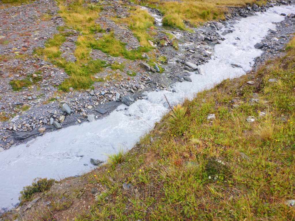
The other two girls and me got up at 6am this morning to get ready while the Canadians waited until 6:30am. The guy from the UK continued sleeping. So I got all my things together and then packed them out on the porch amidst battling the sandflies. By 7:15am I was ready and set off first. The Timaru river was still milky with fine sediment throughout.
The track first continued uphill for a wee bit from the hut, before following down a ridge towards the forest.

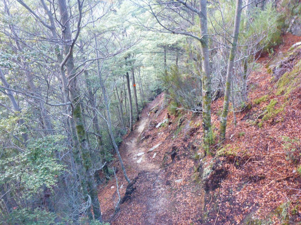
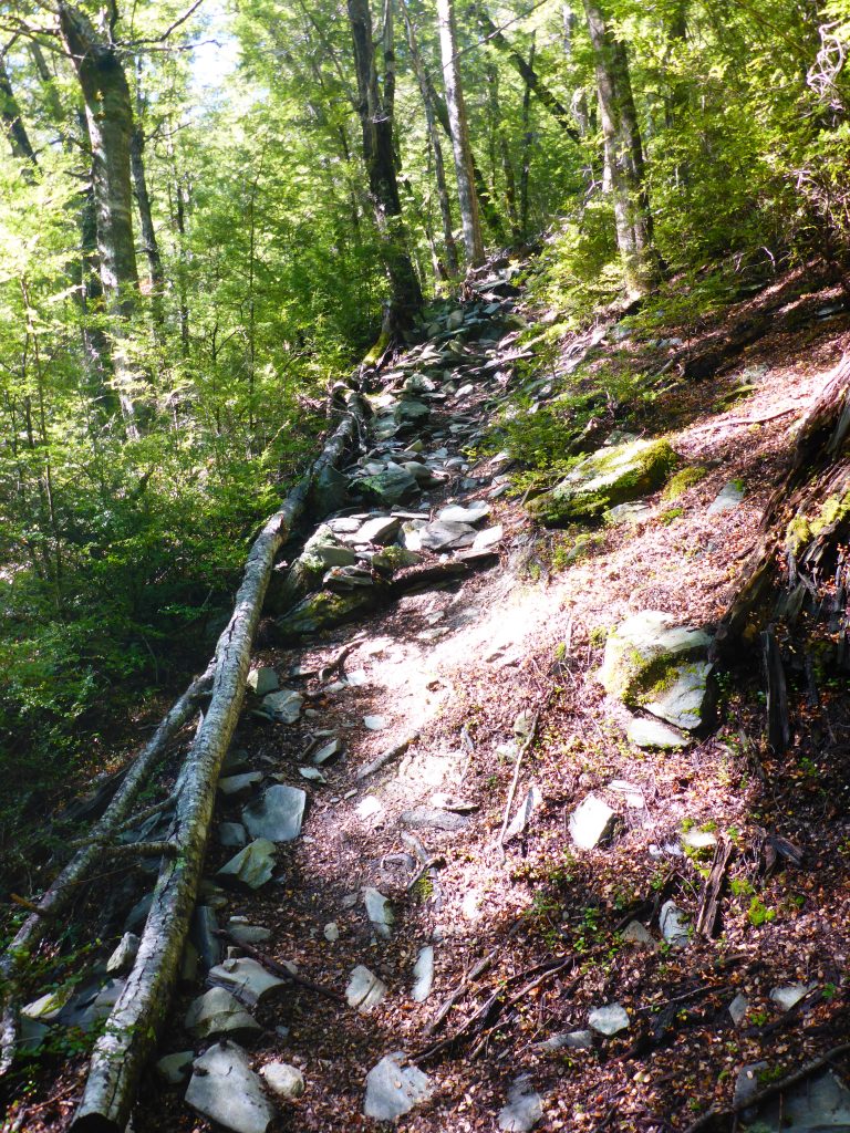
Inside the forest the track didn’t continue along the ridgeline, but siddled along the side of the mountain on very slim tracks that were still wet and slippery. Thank God I’ve got my trekking poles.
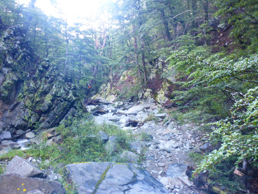
Down in the valley the Trail continued to follow the Timaru river, crossing it numerous times. Due to the milky water it was at times a bit difficult to walk through the water, as you have to blindly set you feet down. But with the aid of the poles this is all doable.
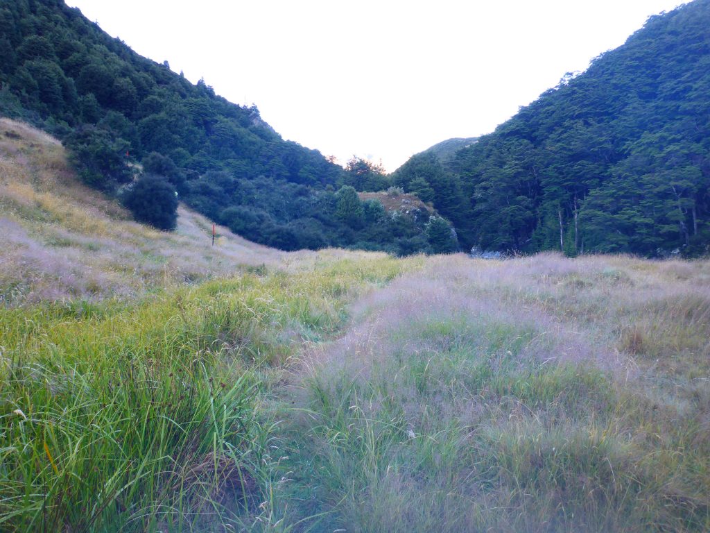
At this point the Canadians had caught up with me and surpassed me. The girls were behind me, sometimes gaining on me and then falling behind again. Some portions of the trail walked through grass sections next to the river. These could have been camping spots in better weather.

Even though the trail follows along the river, it also continued to steeply go up and down in the surrounding forest and siddling along the mountain side. At one instance going up I managed to slip and fall, even though I had my poles anchored in the ground. My feet just slipped underneath me in the wet ground. At least nothing bad happened from it.


At some point I followed the wrong trail through the forest. I realised this when I came upon a section with very sketchy and steep small trails that siddled the mountain, being impossible to pass. So I backtracked to the last marker and then went on.
I also managed another mishap. While trying to fill up my water bottle, I slipped on the stone and ended up sitting in the water of the small creek, my lower half wet, as well as the bottom of my backpack. I also managed to loose the cap of my bottles probably flowing downstream before I was able to right myself and get up with the help of the girl from the UK. That slip could have been so much worse though.
We reached the junction faster than expected. But here the sign said that the next section would take 1.5-2h for 2.2km. This is due to an elevation gain of 500m. And it took that long. I had to stop every so often to catch my breath, but sometimes also to find where I’m supposed to go next.

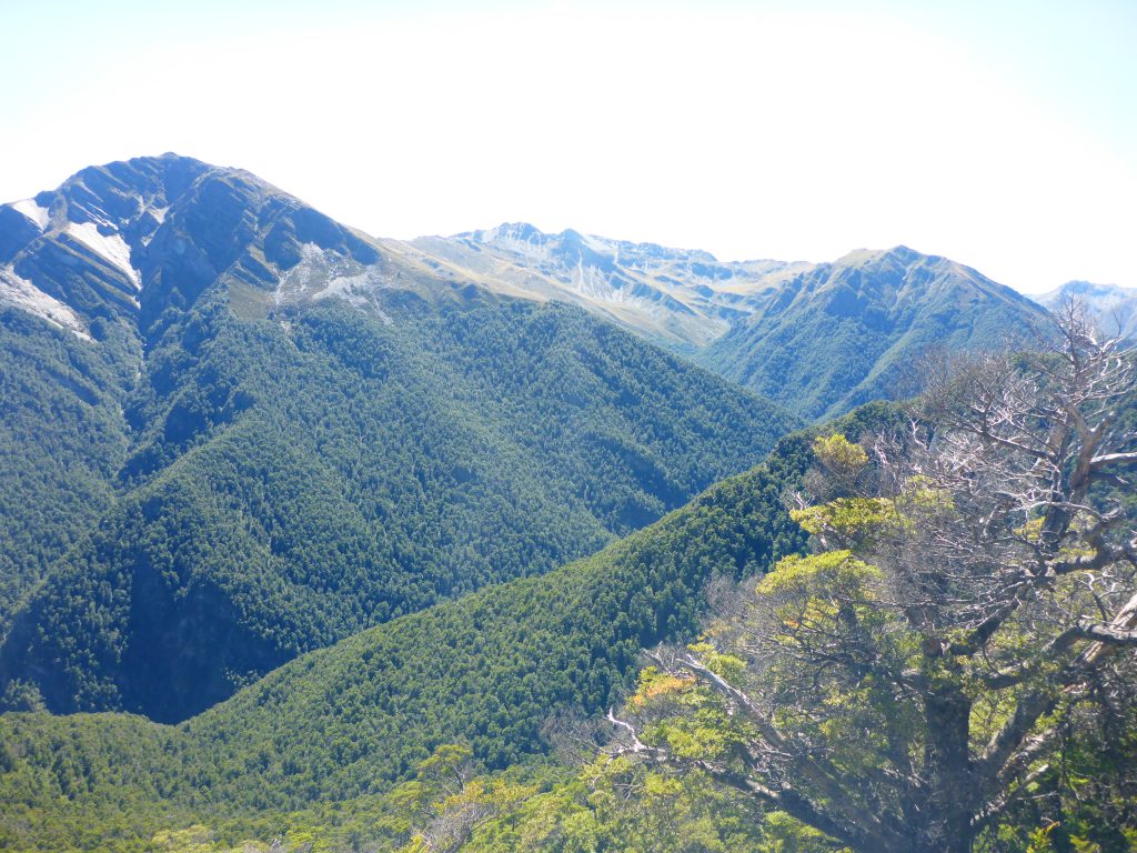
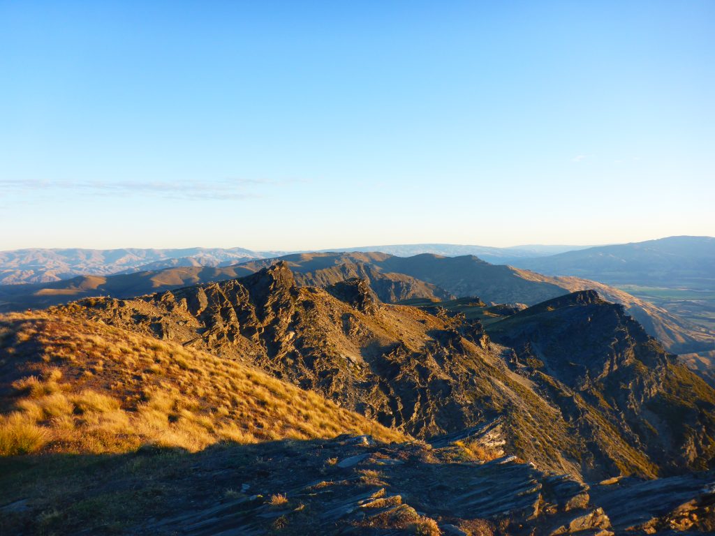
Reaching the bush line resulted in great views of the surrounding mountains, but also in the sun burning down on me.

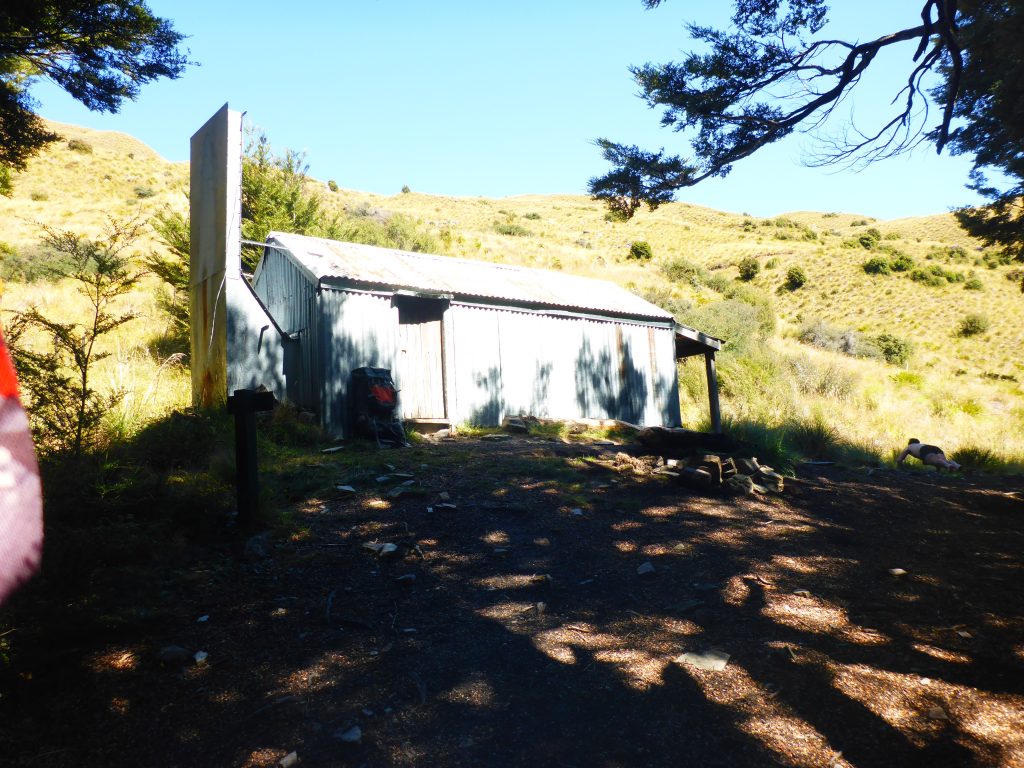
Upon reaching stodys Hut I found the others already there, eating lunch. I also stopped to eat my lunch, use the dunny and apply sun lotion. With the next section being completely exposed it wouldn’t do to walk without protection. The others headed off while I was still getting everything ready. Then I continued on as well.
From the Hut onwards the trail continued on a 4W track, therefore being more gradual in the next 500m elevation gain. But it didn’t go only up, the trail also went down again before going up again. While walking, one of the Canadians came towards me. Turns out he left his phone back at the hut. That’s some bad luck.
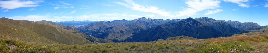
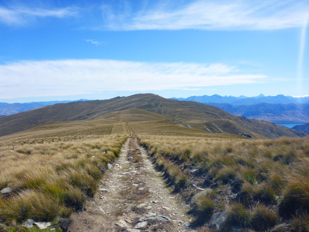
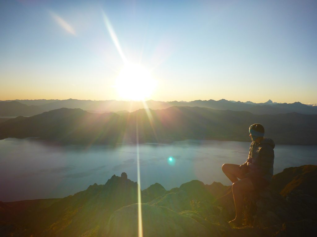
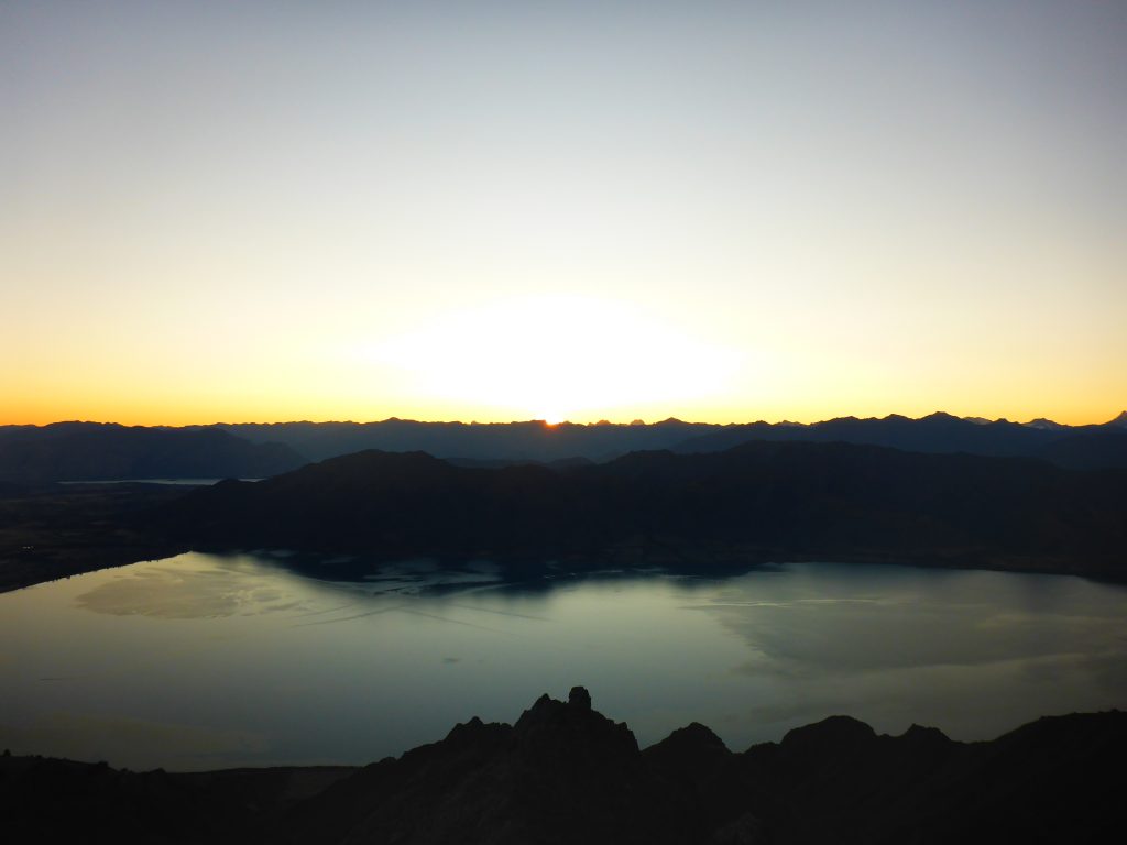
After all that uphill I finally reached the peak of Breast Hill (about 1600m) at 5pm. The others, except for the Canadian going back, were all there waiting. The view down to lake Hawea was breathtaking.
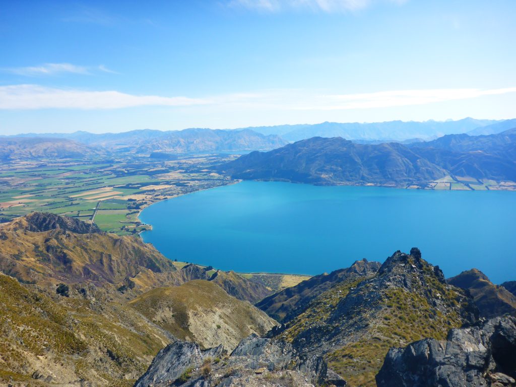
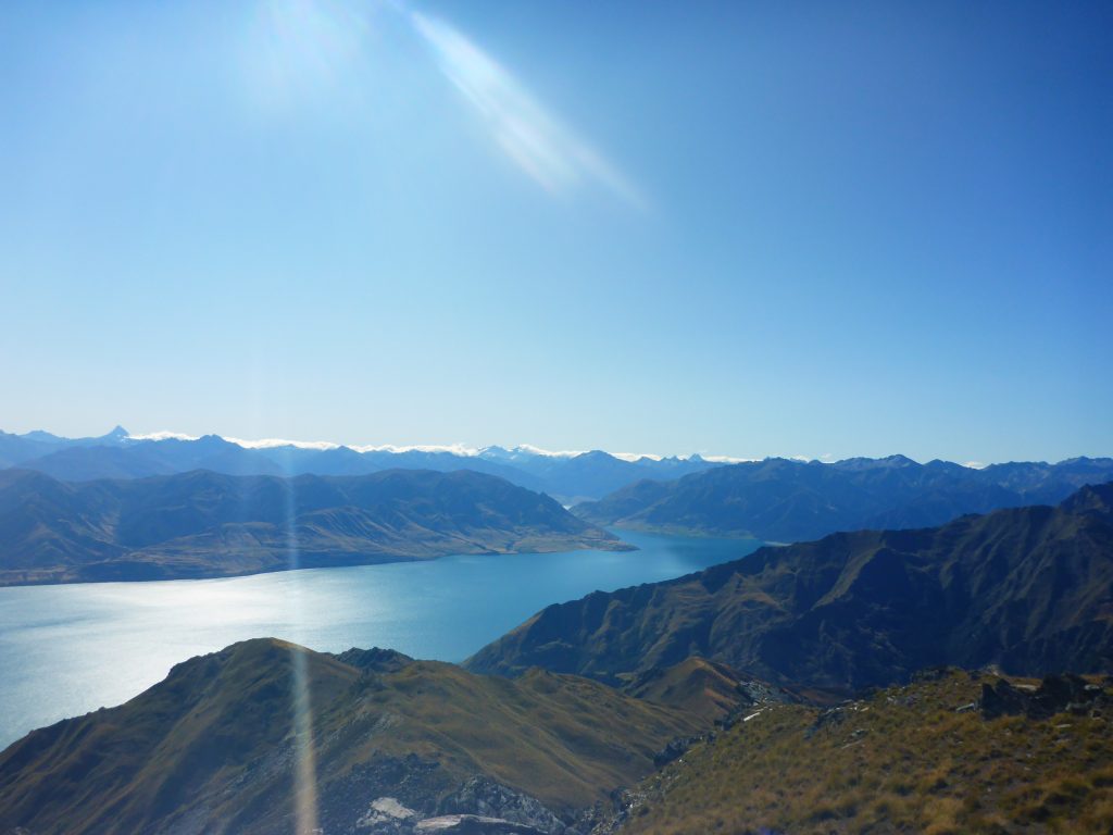
From the peak we could see the spire of Mt Aspiring ahead, and a tiny glimmer of Mt Cook behind. Truly spectacular. The others were all planning to get down towards the Lake that night. I knew I wouldn’t be able to before it turned dark. As i didn’t want to be caught in the dark going down, I only planned to reach the next hut.
Then the girl from the UK started pondering that it would be a spectacular place to camp up here. She didn’t have much water left though, and there was no water source. The others, all wanting to continue down and passing the next hut in 45min anyways gave here some of theirs so she had enough. The idea intrigued me, and after checking the level of my water bladder, I decided to stay as well as I had more than enough water left. So I went about to find a good place to pitch my tent and set it up while the others except for the other girl left.
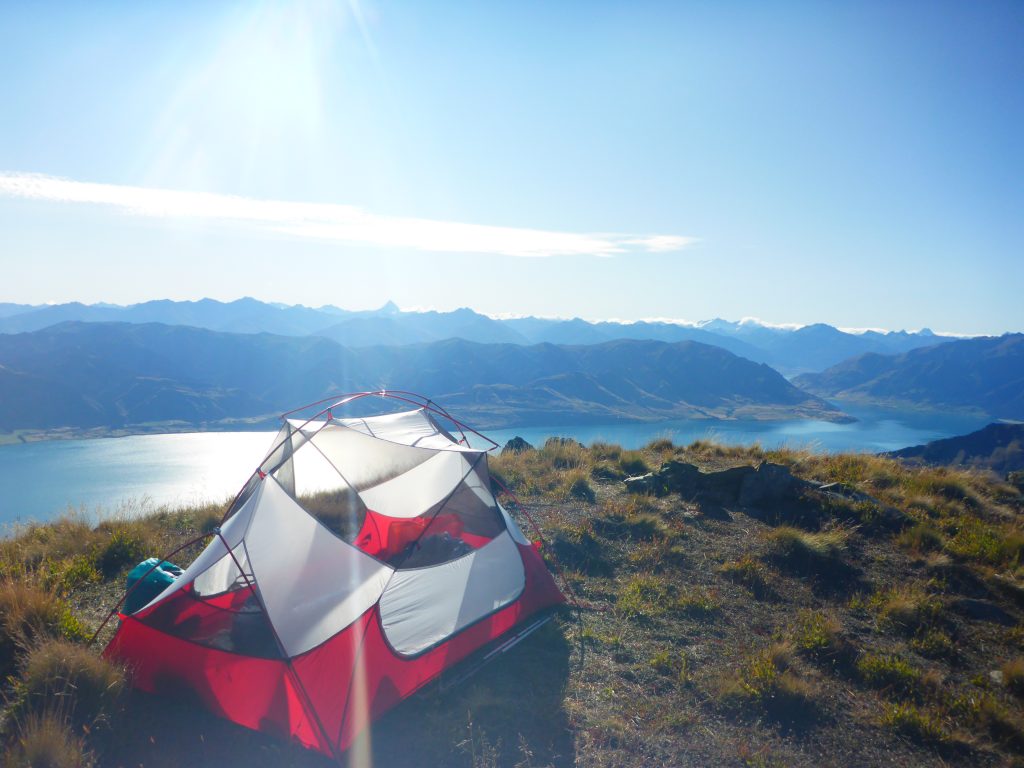
After setting everything up and getting finished for the day I went about making dinner. As it is quite exposed up her and some wind was blowing, I ended up using my sleeping mattress as a wind shield while cooking. It worked well enough, and soon I had dinner ready to eat.

After dinner I had to go and take care of my bowel movement. So I went far out and started digging a cathole with my tent peg and my hands. At least the ground was easy to dig in. It still took about 20mik though until I was happy with my result.

As the sun was starting to set, both of us were back at the peak to take countless pictures. While we were there, a NOBO had come up from the hut. She wanted to walk the alternative 4W track the next day, avoiding the peak, so she came up here now to see it.

After the sun had disappeared behind the mountains we both got ready for bed. As it got really cold without the sun and the wind was still gently blowing, I decided to put up my fly for the night, knowing it will probably be wet with condensation on the morning. I continued though to see the beautiful colours of the sunrise long after the sun had disappeared.
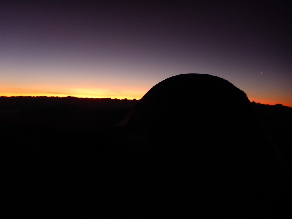
With it being dark, I then went to bed at 10pm.