Te Araroa SI Day 19: After the storm
From Arthur’s Pass to Hamilton Hut
Hiking time: 10:15a.m.-05:50p.m.
Daily/Total distance: 24.5km (5.5 skipped) /499km (185.5 hitched/skipped)
Steps: 34657
Weather: cloudy with some drizzle and some rays of sunshine in between
After the previous days bad weather I’m now ready to continue on with my journey. While the sanctuary in Arthur’s pass is a nice place, I me here to hike and not sit indoors. All of us staying had a lazy start in the morning. Nevertheless I set off at 9am. I went to the DOC office to ask about trail conditions. They didn’t know anything yet about the forthcoming section but mentioned that if the river is to flooded to cross I should wait it out. As if I didn’t know this myself. I then tried to get a ride the 12km down the road to the bealey hotel where my food parcel still needed to be picked up. With the bad weather though there weren’t as many cars going. Within 5 min though a man stopped by who was also going to the trail head to hike this section until Tekapo. He dropped me off at the hotel and drove on. I might meet him again later on.
At the hotel I picked up my food and was shocked to see that the box had a weight of 4.5kg. I still had about 3 days of food from the previous section and here waited another 4 days. I didn’t want to give it all away though, so I packed what I wanted, mainly snack and breakfast and gave the many pasta dinners to the proprietors of the hotel to put into a hiker box. Then I started walking at 10:15am.
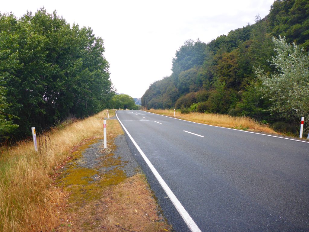
For the first 3.5km I had to walk next to the highway to reach the actual trail head. The road was a bit busier than before. There was only a slight drizzle accompanying me. Luckily there was quite a bit of grass next to the road so that I had enough space to walk on.
By 11am I had reached the trailhead next to the Arthur’s Pass wilderness lodge. Immediately after the start was Bealey Hut where I signed the intentions book.
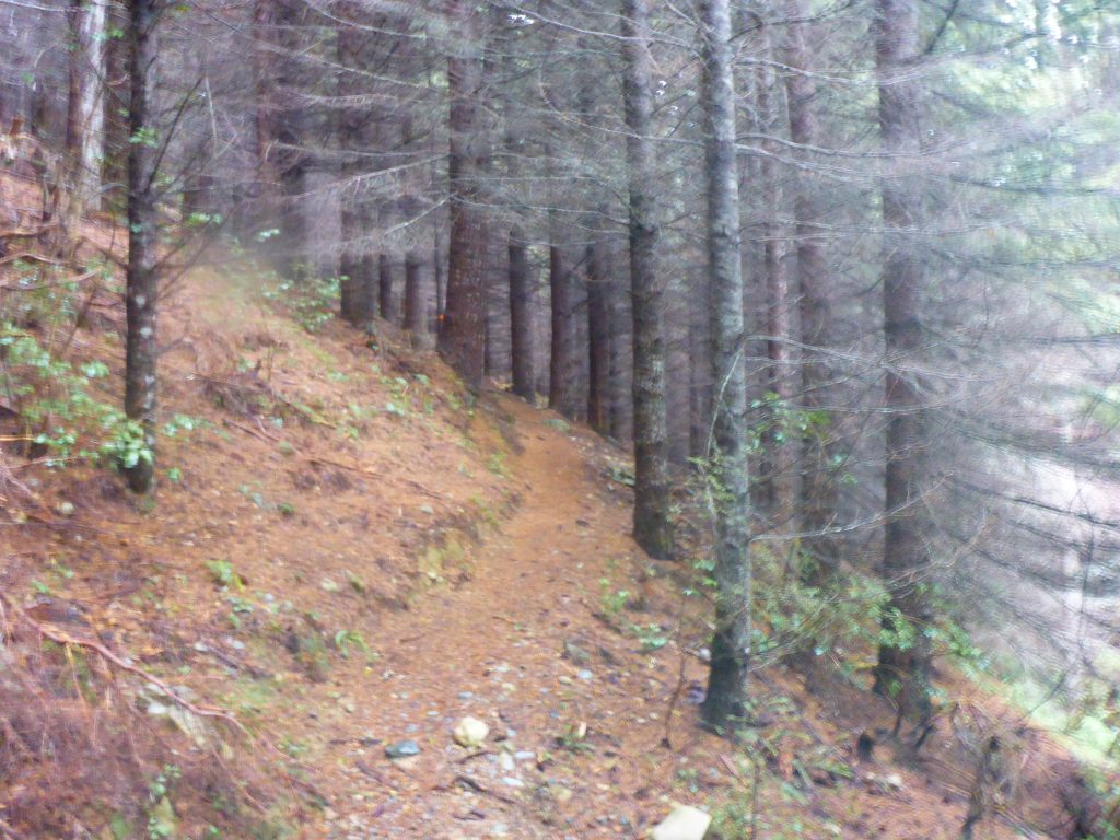
The track went through quite a bit of forest and uphill to start out with. Some of the forest was beech, then followed pine forest. Inside the line forest it was quite dark even though it was the middle of the day.
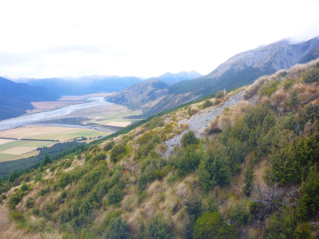
Then the track continued further up above the bushline towards Cass Lagoon Saddle, first going though some higher bush and then opening up the views of the valley.
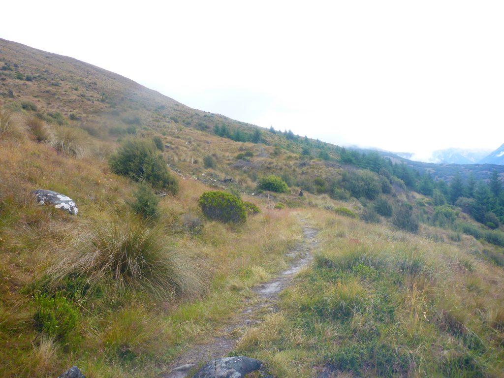
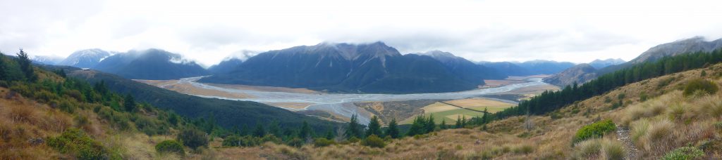
Due to the recent heavy rainfall, some of the sections up above the bushline were quite much to walk through. I mainly managed to mostly keep my shoes and feet mud free.
All to soon though the trail went back into the trees and through beech forest. Some parts of it were a bit steep and due to the wetness quite slippery. In the forest I came upon A Frame Hut.
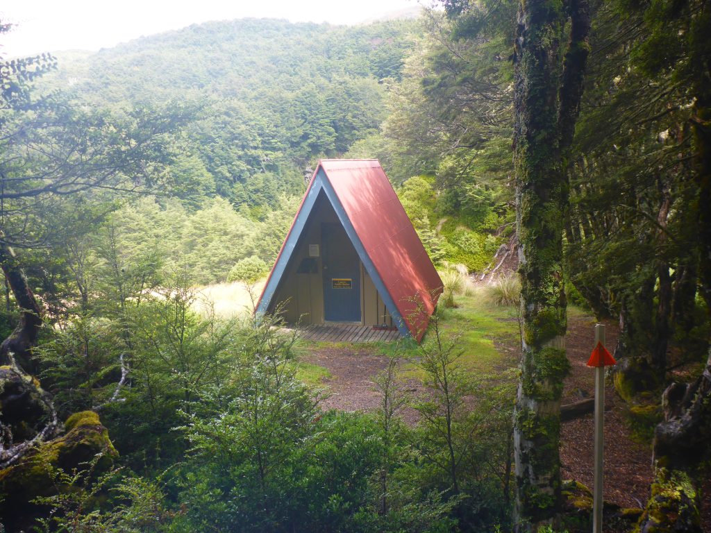
Even though there are supposed to be 3 bunks in this basic hut, there was only one bunk and one mattress. Someone had left two yoga mats though, so I guess you can count it as two? I only made a short stop to sign the intentions book and then continued on.
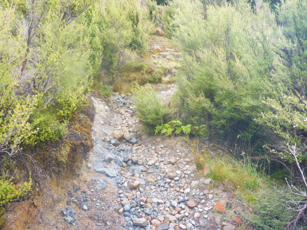
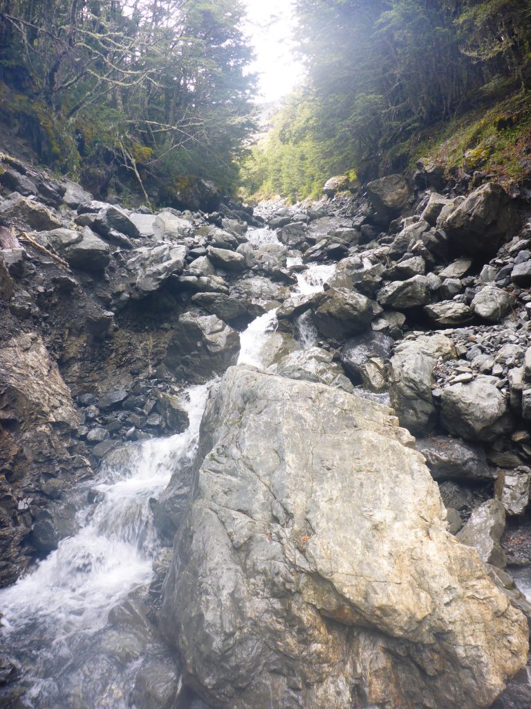
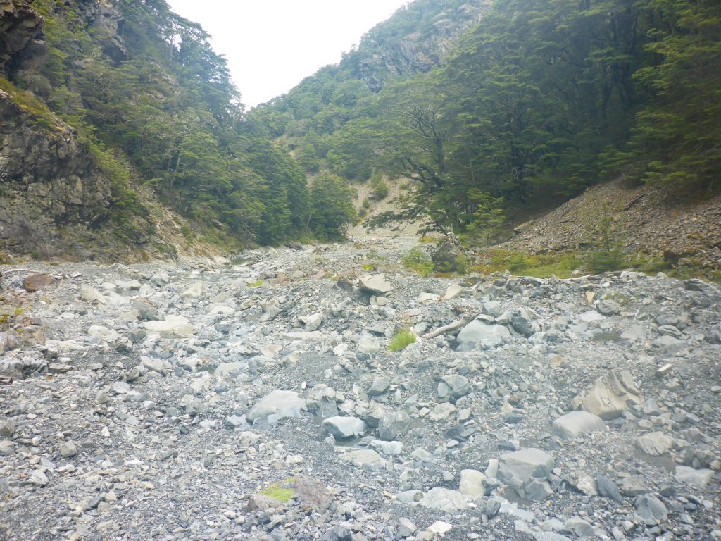
By now the track was so far down the saddle that there were more significant river crossings. Furthermore, the track follows the Harper River downwards and includes numerous crossings of the same river. This was the river I was warned about at the DOC office but the water level was completely fine to cross solo.
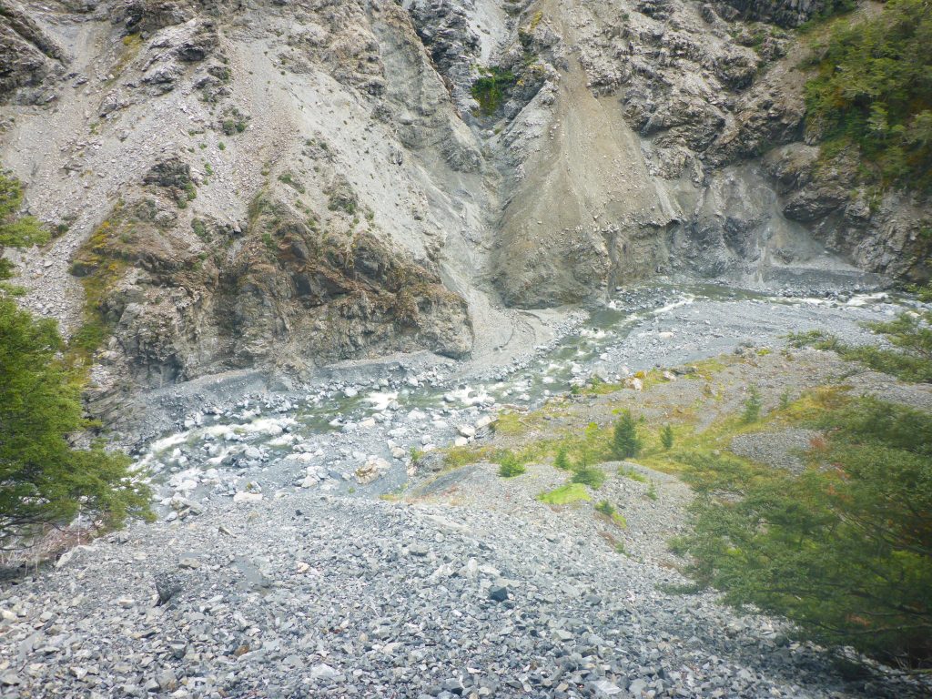
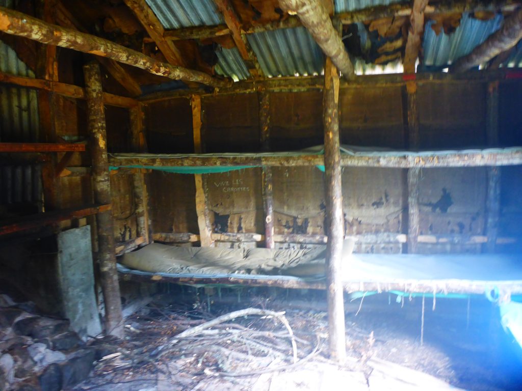
Further down the river I came across West Harper Hut. An old hut that seems to have quite a bit of history. The inside though does not look to inviting to stay in unless to ask shelter in a bad weather situation.
Now the track followed further down the river. There were no more significant crossings that I can recall. Half an hour before the hut the river is crossed again but this time on a swingbridge. Here I also met the friendly kiwi driver from this morning.
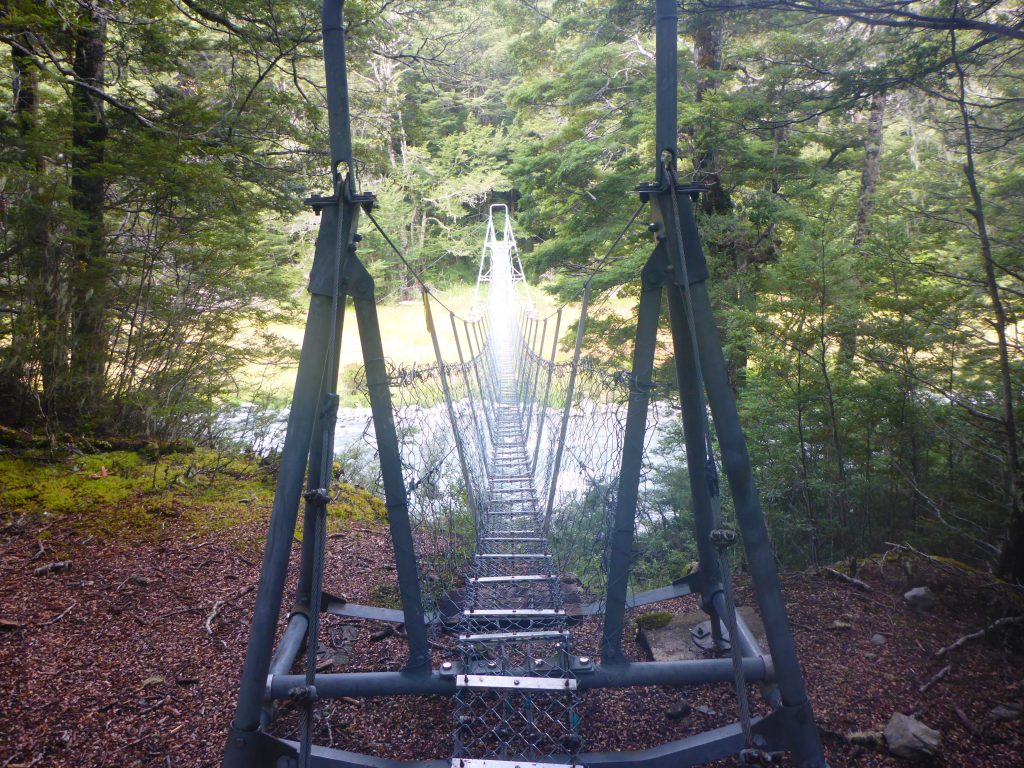
After that swingbridge there was a further 20 min to go through the muddy grass next to the river before the track turned off over a side river with another swingbridge. This one looked way more welcoming than all the previous ones I had to cross.
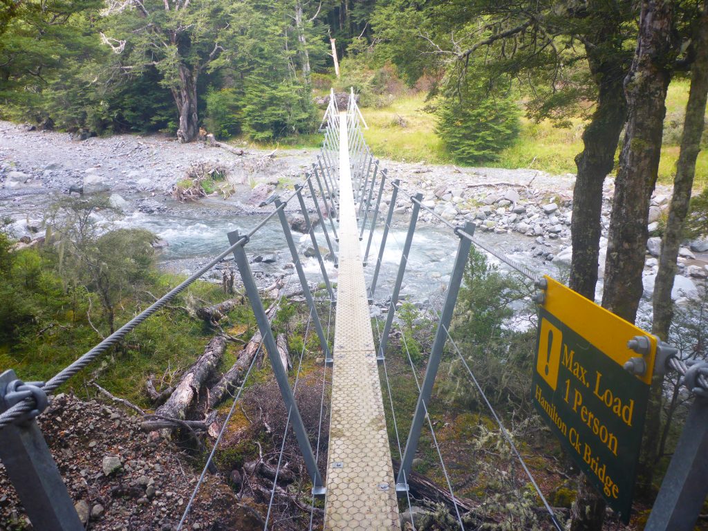
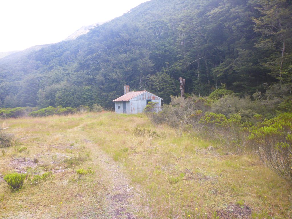
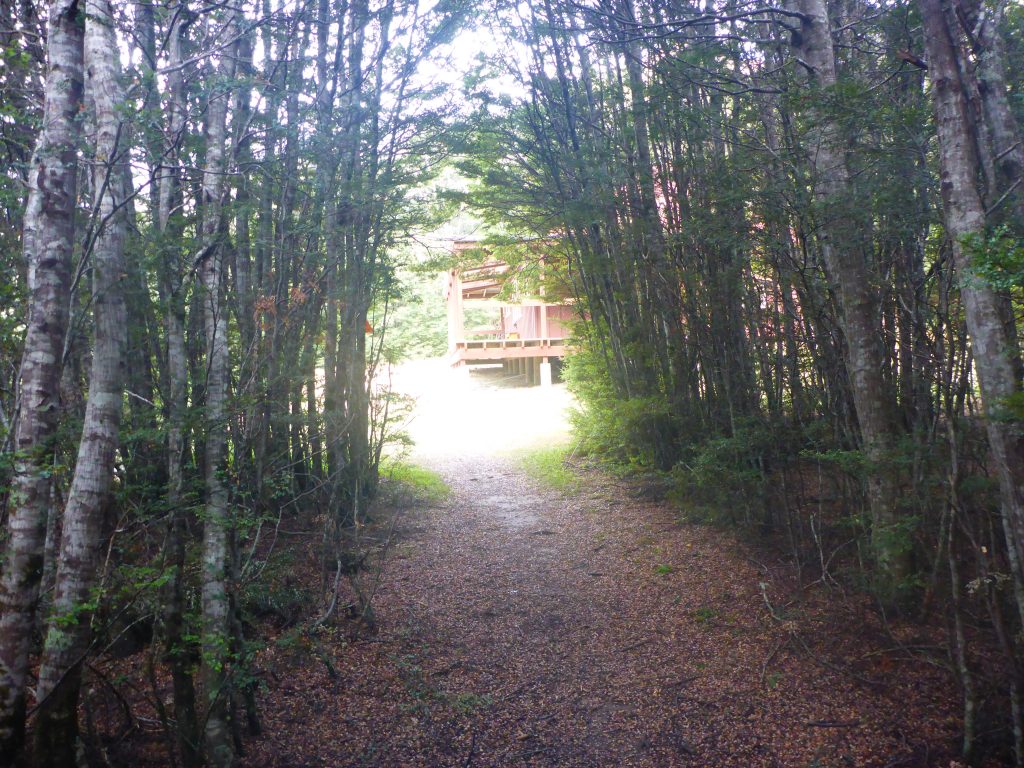
From tthe swingbridge it was quite a track, 10min, off trail to reach my destination for the day, Hamilton Hut.
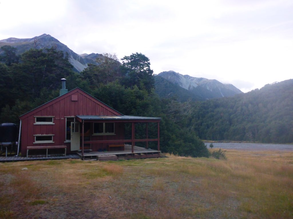
IInside the hut were the two Canadians who were with me the day before in Arthur’s pass. There was furthermore the couple that I had stayed with at the same place again and again on the previous section. While I sorted my things my driver from that morning also arrived and a bit later a Scotsman I had previously met a couple of times. Our group was complete by a Finnish guy joining us quite late. He told us he had started walking from Arthur’s pass that morning. Including the 12km along the road.
While we were a merry bunch and had some nice conversations I was really tired and started dozing off in my bunk by around 8pm.