Te Araroa SI Day 13: Over the second highest point of the trail
From Blue Lake Hut to Waiau Hut
Hiking time: 09:30a.m.-07:00p.m.
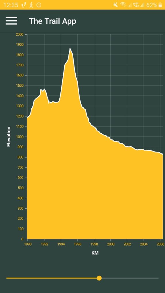
Daily/Total distance: 15km /301.5km (140 hitched/skipped)
Steps: 27565
Weather: First cloudy then sunny then rainy
I got up with most others inside the hut at 7am. The water outside was cloudy though so I was reluctant to get ready to leave. I don’t want to cross this high pass with no visibility. So I decided to wait for the weather report from the hut warden at 8:30am. According to the report there would be fine weather with high clouds, isolated showers in the afternoon. Winds from 50 down to 20km/h at 2000m and 30 down to 20km/h at 1000. Freezing level is supposed to be at 2700m.
With this report I decided to embrace the cloud and hope they will dissipate by the time I get to the pass as the weather is supposed to clear up. Though I would have also have had enough food to stay an additional day or two. So I set out at 9:30am. 2h later than originally planned… I will definitely not get a bunk tonight.
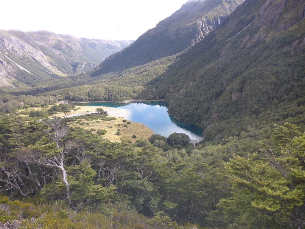
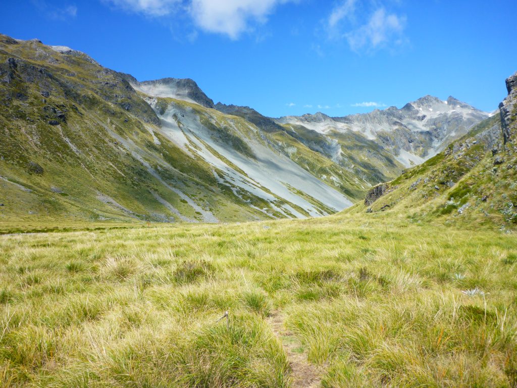
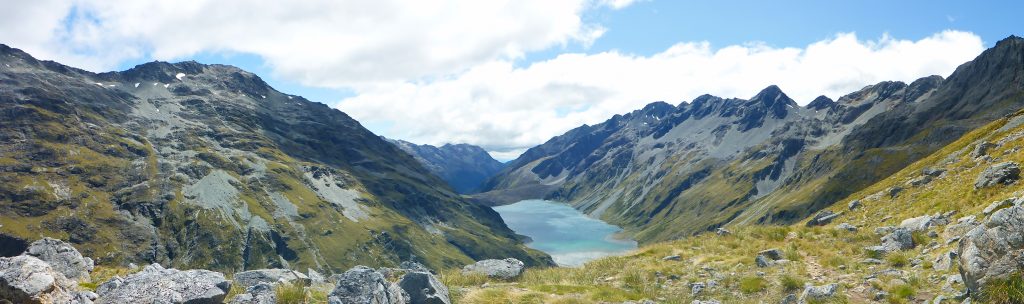
The first part of the track lead steep uphill going up from blue lake to lake Constance which feeds into the blue lake. The uphill was hard but not too bad. There were great views to be had back on the blue lake.
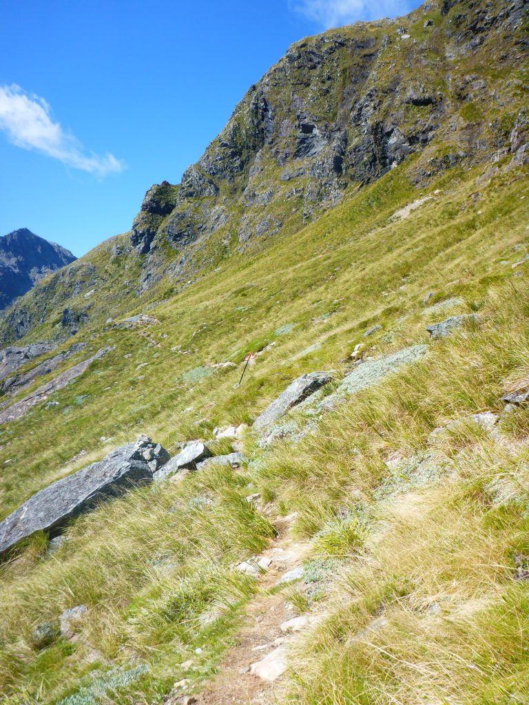
The track also didn’t always go steep uphill. There were a few meters were it flattened out and was easier to walk on.
Upon reaching lake Constance though the track did not go to the lake or walk along its shore. No, the track went further up a steep scree slope.
Going up the scree slope was hard but the view of the lake was worth it.
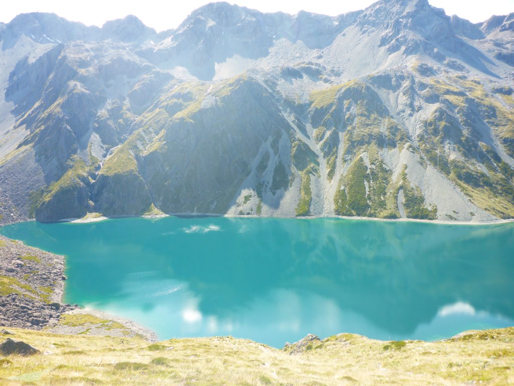
The track then followed next to the lake at the level above the lake that was reached going up the scree.
Towards the end of the lake the track descends steeply down to the lake.
Then the track follows the lake to its head and further into the valley.
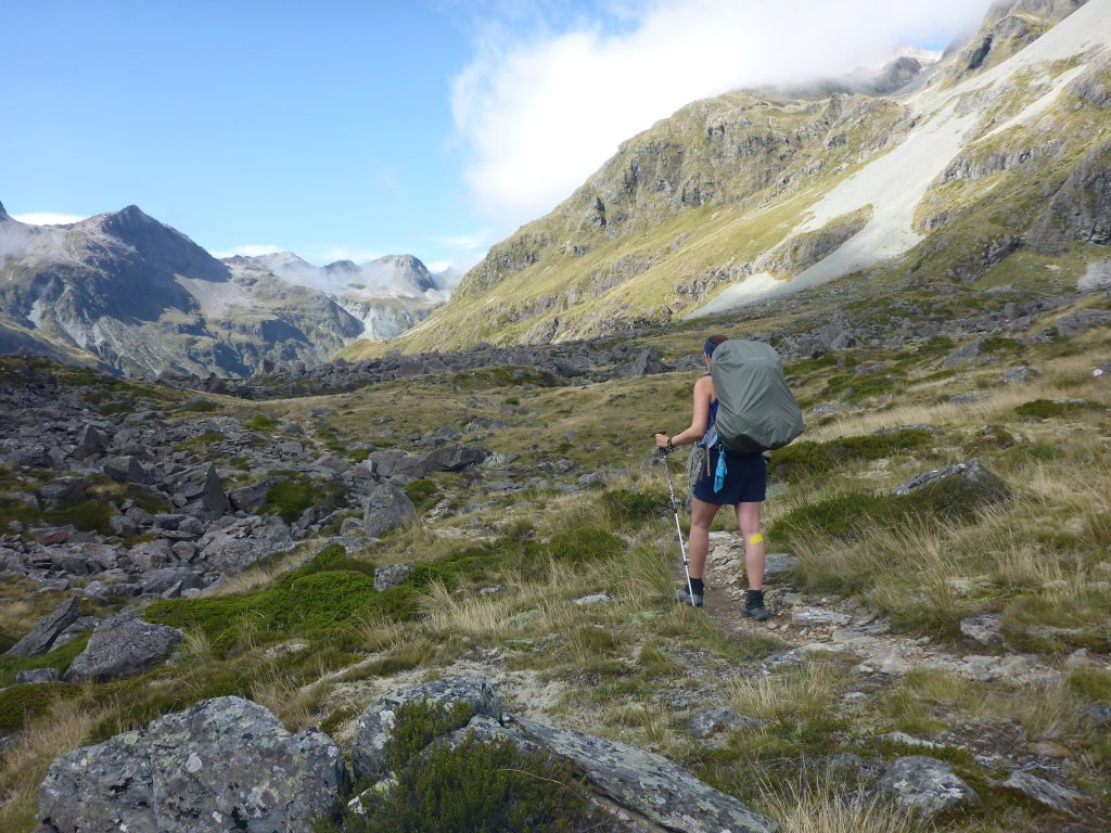
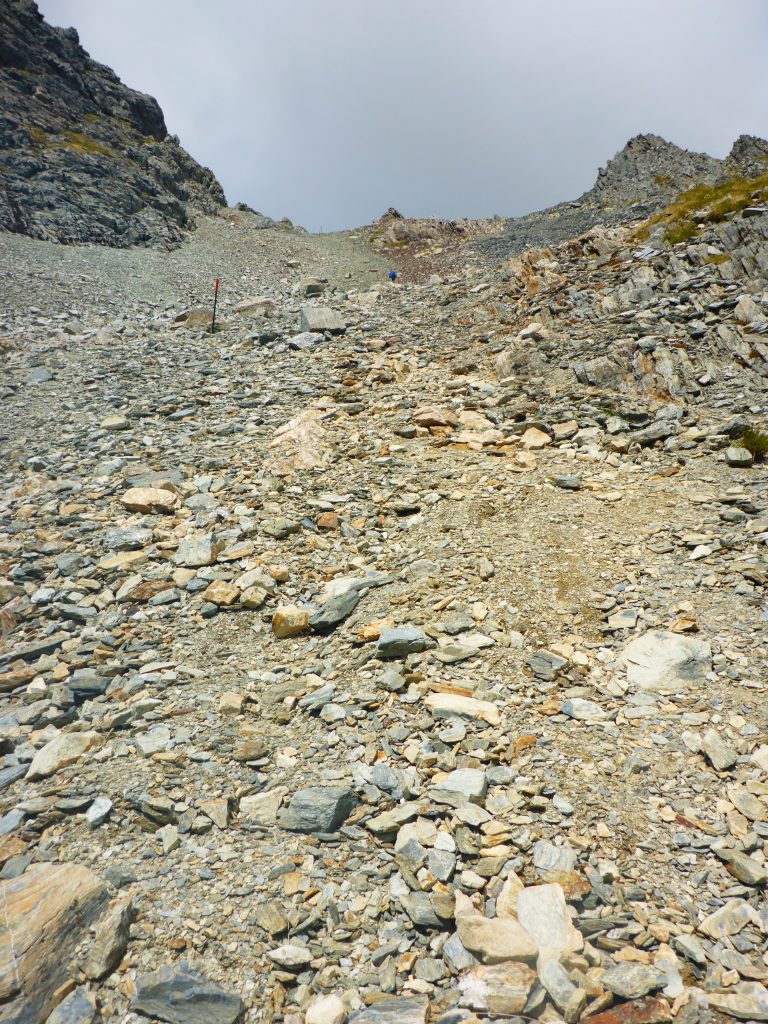
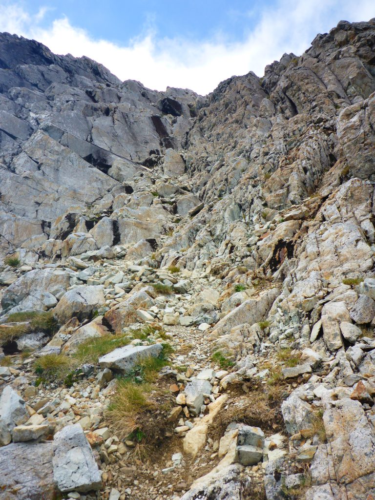
Upon reaching the part where the pass is, I realised that I would be a very very steep ascent. I had not looked at the elevation profile before and was unaware of this fact until now. Now I was looking up a steep scree slope with another hiker in front of me further up so that I could see where I would have to be at some point.
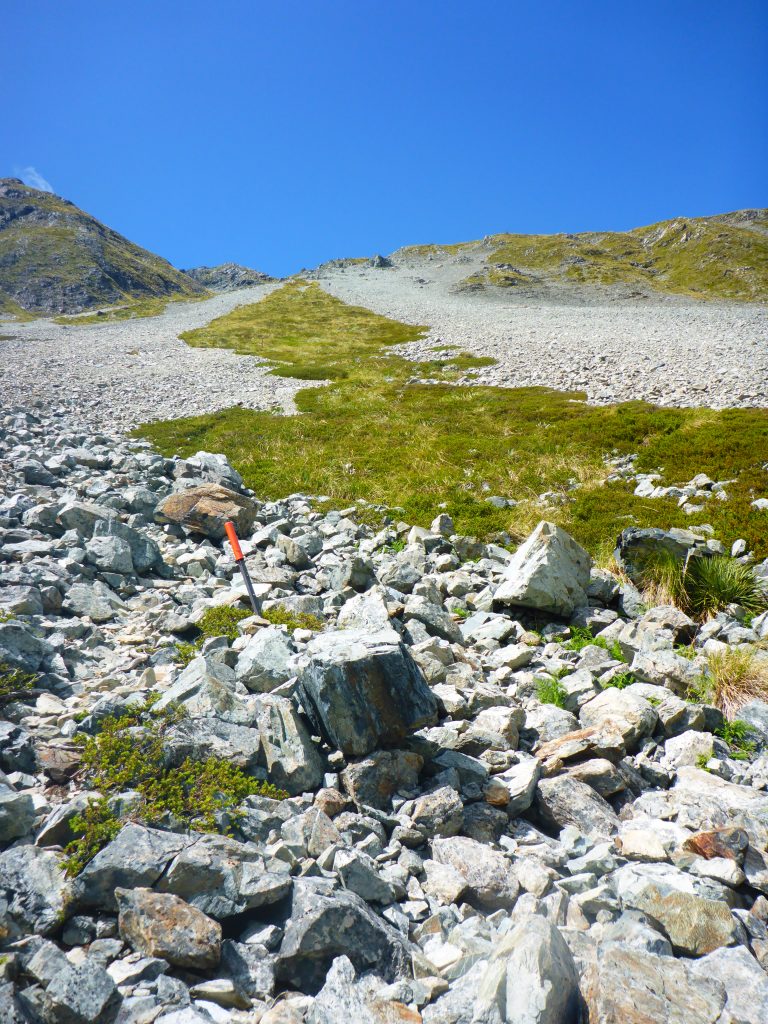
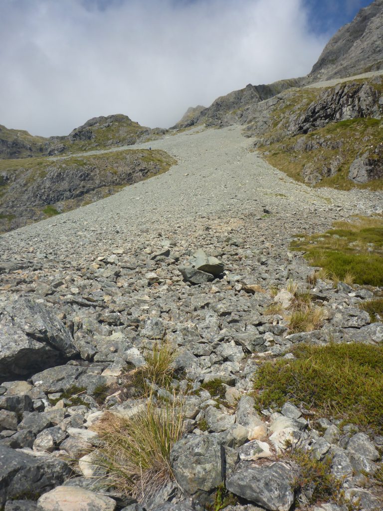
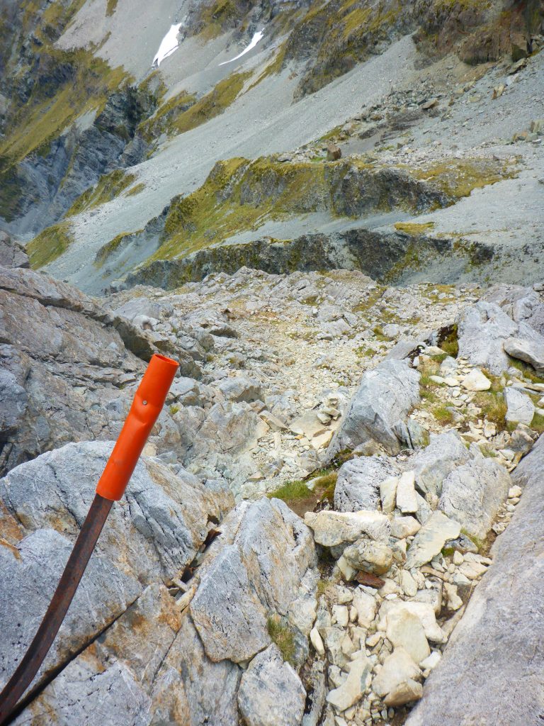
Going up the scree was hard work. At times I though if I stumble and fall over I’m going to roll down the whole way until the caller with the lake. But there is no space for such thoughts. I took short breaks next to the snow poles guiding the way and always held onto them to make sure I have something solid holding me where I am. In the distance I could see clouds moving in and I wanted to reach the top before they were here. The further I went the more wind there was. So I continued on.
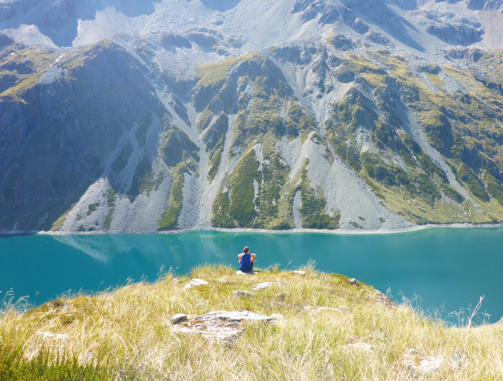
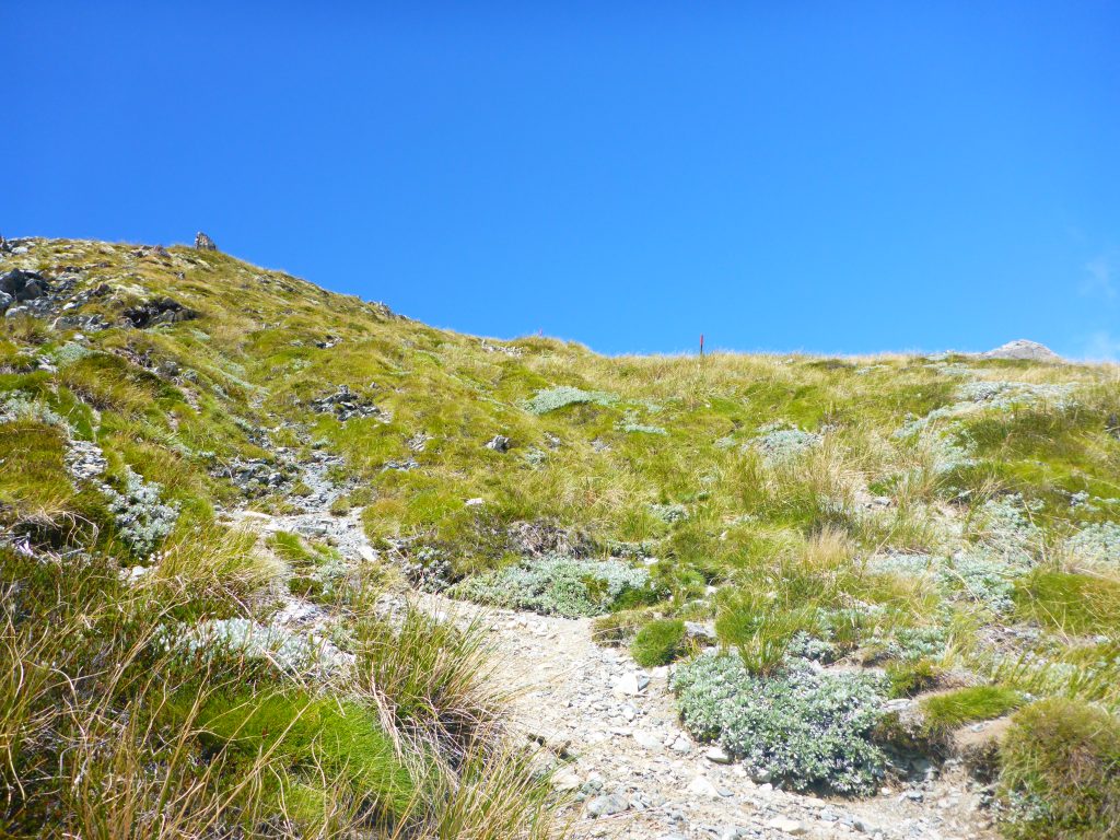
Free 30min I reached what I had originally though to be the top of the slope only to realise that I would walk further right for about 500m before going up another scree slope. At this point it started getting quite cold with the wind. So be for I set of for the next scree I put on my long sleeve and the rain jacket as well as my hat. I also used this moment to take some last good picture of lake Constance before it will disappear behind a bend.
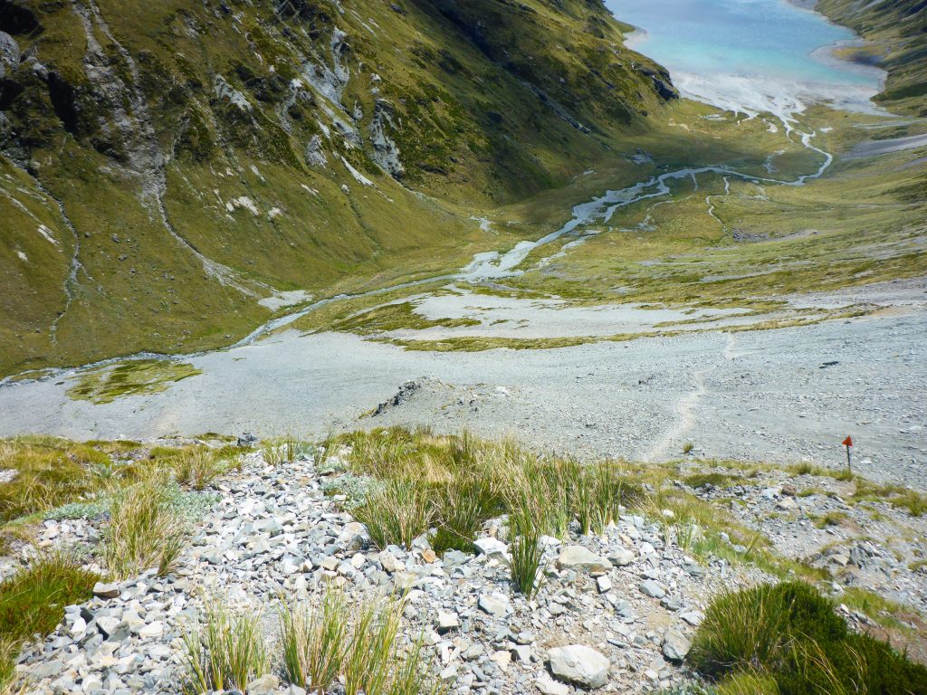
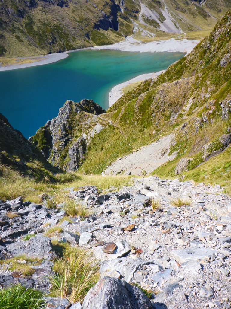
After about 1.5h I finally reached the Waiau Pass enjoying the view into the valley I just came from as well as the one I’m going down to.
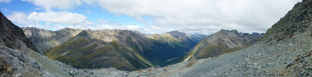
At the top I had a short break eating some bars as well as checking my phone as I got reception. I got some more recent weather information for the upcoming days and reassured my family that one as not in the part of New Zealand that had been hit with the worst floodings in their records. While I was doing this I started getting really cold and my fingers a bit numb from the wind chill. So it was soon time to head down into the next valley and find a spot for tonight.
Going down was quite tricky. The first bit was very steep and I had to sometimes support myself with both hands pressing into the rockfaces on either side of me while lowering myself down. This ment I had to stow away my trekking poles as they were no use here. There were even sections where I turned towards the mountain and climbed backwards down as this was a safer alternative with my backpack offbalancing me.
Halfway down the rocky section it started raining. This made the whole venture even more tricky as the stones now also became slippery. I was so happy when the track finally reached grassy grounds. Although it still continued downhill and I was therefore quite slow.
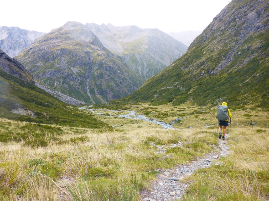
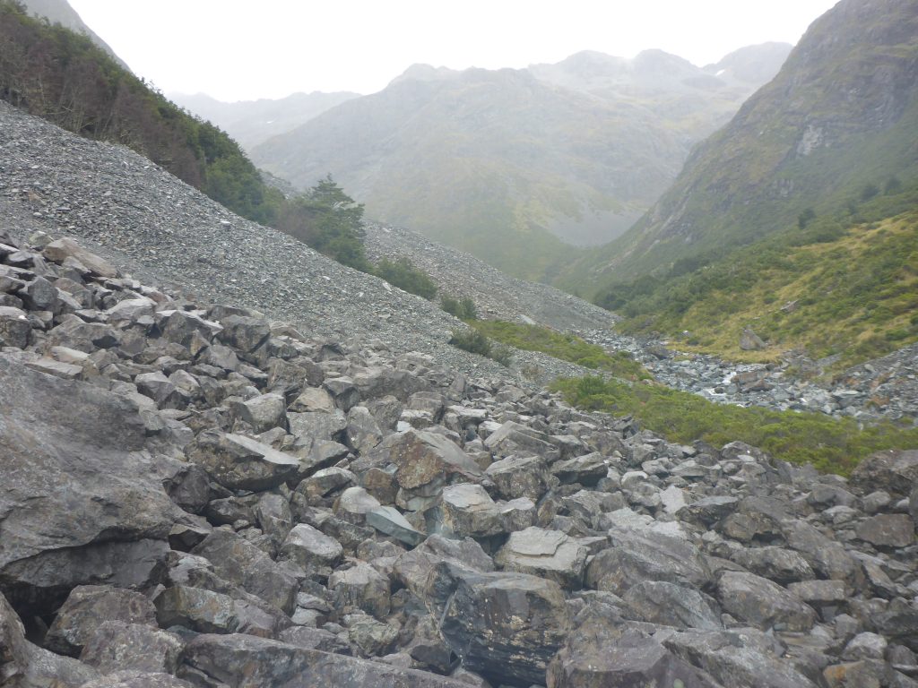
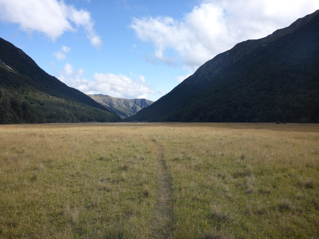
The track now followed the river through the valley. There were some avalanche paths again. These are not marked as before. I guess there are less people going here and putting up signs isn’t quite worth it. As it was still raining I took a long time to scramble over the rocks. This would have been nicer in drier conditions.
Finally the track and the river arrived down in the valley and there was little more downhill that was to be noticed. At this point it had stopped raining but it was still quite cold. Some time later the sun even came out again.
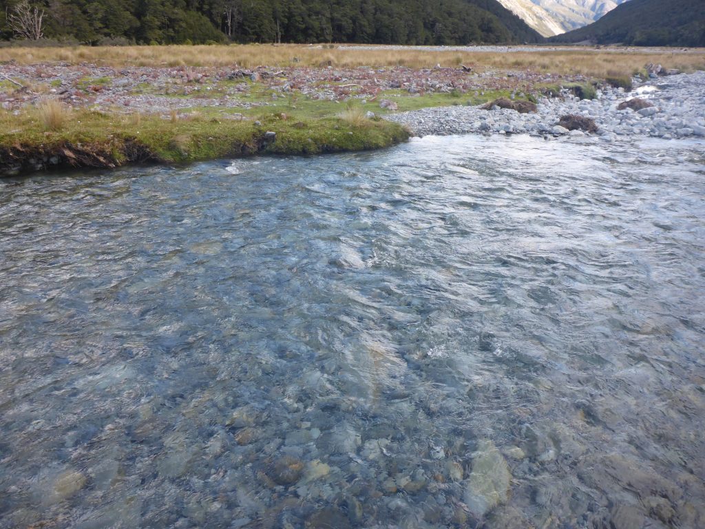
In the flat I found quite a few spaces there were quite nice to pitch a tent. But I still had the hope of getting a bunk in the hut and sleeping inside so I continued on. Just before the hut there was one water crossing without stepping stones and I once again reached the hut with soaking wet feet.
At 7pm I finally reached the hut. It was on the edge of a nice plain.
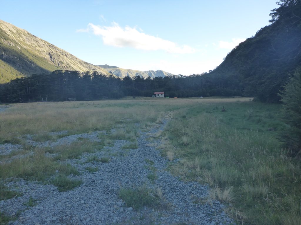
Sadly enough though, the hut was already full. 6 bunks is just not enough. Outside were already 4 people in tents. So I went to find a flat spot to pitch my tent. I could have continued on for a bit longer to look for a flat spot but I wanted to have to facilities from the hut. This meant I could also eat inside where it was warmer.
After pitching my tent I went inside to make dinner, filter water and sort my food for the next day. I made couscous for the first time on this trail and it turned out perfectly. Maybe I might take some more with me in the future although I’m way to big a fan of the ramen bomb:)
At 9pm I was getting ready in my tent and by 9:30lm it was dark and I started to go to sleep. Not much yo do outside as it is dark and there are you tless sandflies outside in this area.